Publication in Urban Forestry and Urban Greening
16 September 2020
See full article: https://doi.org/10.1016/j.ufug.2020.126797
The effective integration of biodiversity, ecosystem functions and ecosystem services (ES) indicators into green infrastructure (GI) planning and conservation constitutes an important challenge for landscape and urban planners. In this study, we developed an operational framework for GI planning at the landscape scale in the Province of Barcelona. Building on the ES cascade model, the framework integrates a comprehensive assessment of biodiversity (including functional biodiversity), ecosystem functions, and both ES supply and demand, to assure a sound knowledge basis for GI planning. Specifically, we aimed at: (1) identifying the quantitative relationships and spatial patterns of biodiversity, ecosystem functions, ES supply and demand indicators; (2) assessing the mismatches between biodiversity, ES supply and demand and (3) prioritizing key areas for GI planning which respond to various conservation objectives and human demands. Our study underscores the crucial importance of peri-urban green areas, including forests or crop areas, for the urban biodiversity, ecosystem functions and ES provision. We further observe an important mismatch between the supply and demand of ES at landscape scale. In general, peri-urban forests provide a broad diversity of ES; heavy urbanized areas, including the city of Barcelona and its metropolitan area, as well as areas along the coast concentrate the highest ES demands, while areas combining high ES supply and demand are especially found in the urban-rural fringes. Our study revealed that the urban fringes should be critically focused on when integrating both ES and biodiversity indicators into green infrastructure planning at landscape scale. Our approach has been successfully implemented into landscape planning in the Province of Barcelona, reconciling both biodiversity conservation and ES enhancement in practical GI planning.

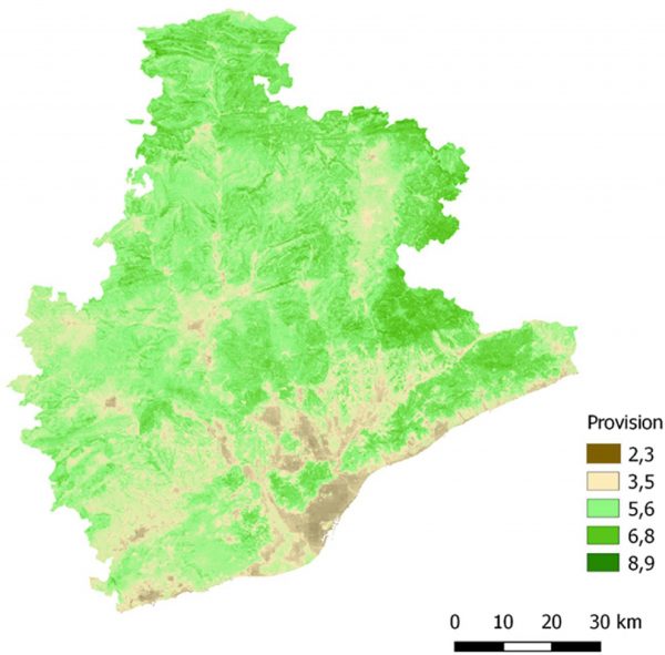
Aggregated map of biodiversity, functions and ES supply, representing total provision.